‘Porters Pass to the Main Divide’
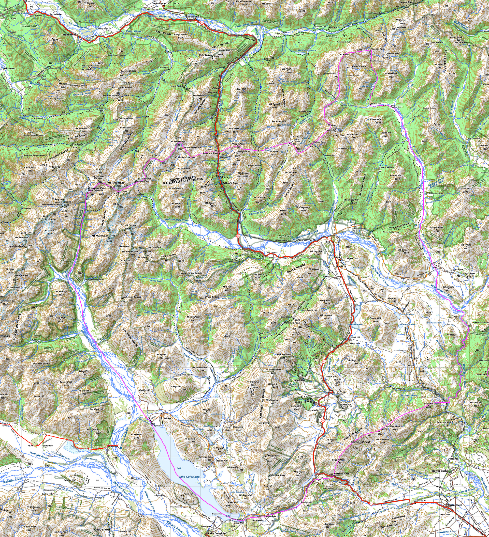
Approximate perimeter of the area
Follow the Purple line clockwise from Porters Pass
Porters Pass – Lyndon Road – Lake Coleridge – Wilberforce River Valley
Main Divide at Browning Pass – follow Main Divide north to Arthurs Pass and on to Minchin Pass
Poulter River Valley to Waimakariri River
Upper Waimakariri Gorge down to junction with Broken River
Torlesse Range – Porters Pass
Red line – SH73
Orange dotted line – public side roads accessible by 2WD vehicle
[Note: if your photographic opportunity lies outside this perimeter by just a few kms, then go for it – your image will not be rejected. A few examples – the Upper Otira Valley, Trig M by Porters Pass, Peak Hill by Lake Coleridge, Lake Browning, just beyond Browning Pass]